History Published on 21 June 2026
Pointe du Hoc: Hours, Access and the Rangers' Assault
Cliffs scaled by the Rangers on 6 June 1944, bomb craters, free year-round access: everything you need to visit Pointe du Hoc from Arromanches, Normandy.
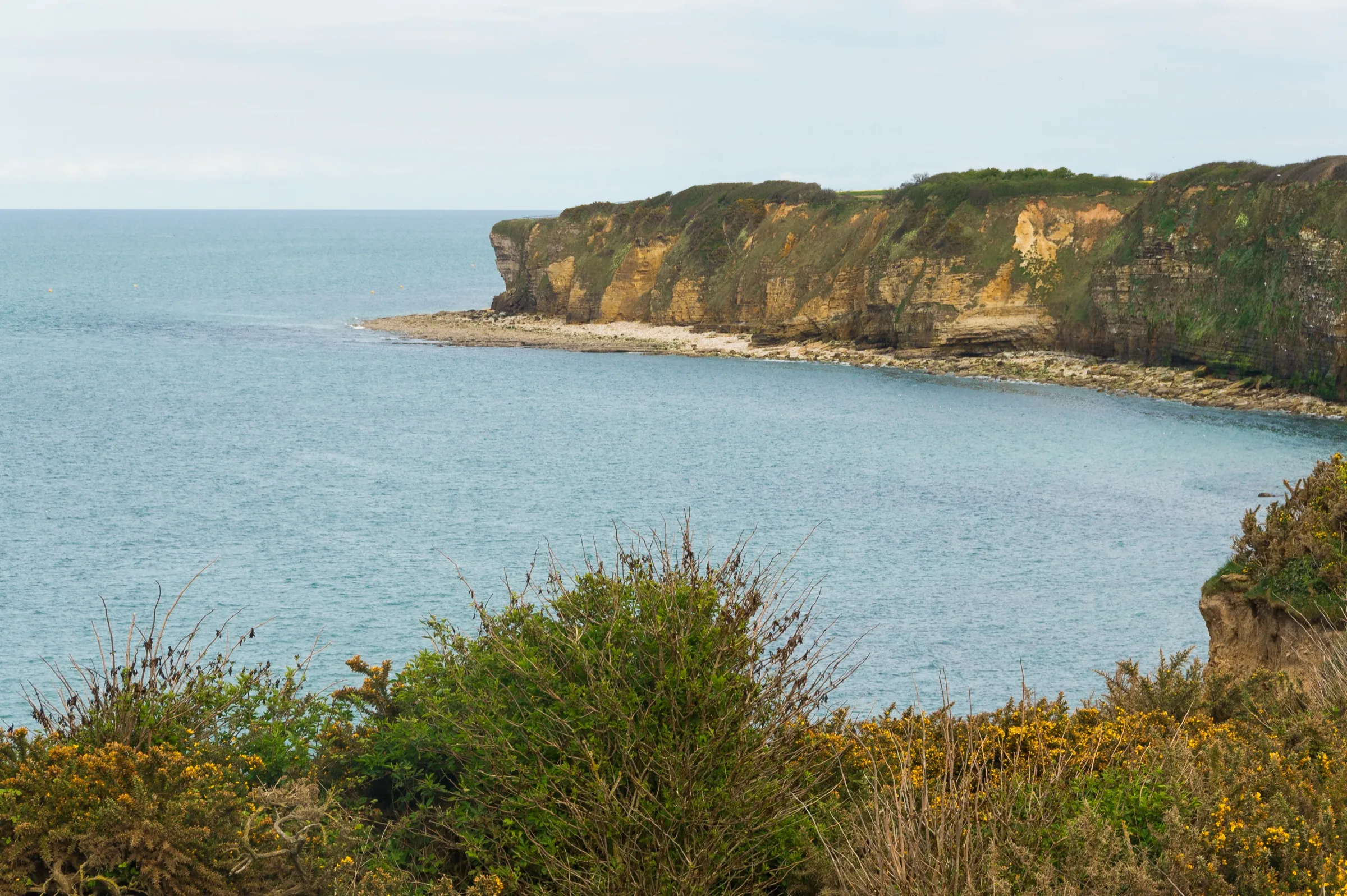
Halfway between Utah Beach and Omaha Beach, a 30-metre rocky headland juts out over the Channel: Pointe du Hoc. This bomb-cratered promontory was the scene, on the morning of 6 June 1944, of one of the boldest assaults of D-Day — the scaling of the cliffs by American Rangers under Colonel Rudder. Today managed by the American Battle Monuments Commission (ABMC) and free to visit year-round, Pointe du Hoc is an easy trip from Arromanches-les-Bains, about 30 km to the west. Here is how to plan your visit.
What is Pointe du Hoc?
Pointe du Hoc is a rocky headland jutting into the Channel between what would become Utah Beach to the west and Omaha Beach to the east. Its commanding position, roughly 30 metres above the water, made it an ideal observation and firing point for the German army, which installed a battery of six 155 mm guns there, capable of covering both Allied landing beaches. On the pre-D-Day intelligence maps, this site was considered one of the most dangerous positions along the entire Atlantic Wall in Lower Normandy.
What happened here on 6 June 1944?
At dawn on D-Day, the mission to neutralise this battery was given to the 2nd Ranger Battalion under Lieutenant Colonel James Earl Rudder — 225 men from Companies D, E and F, backed up in reserve by the 5th Ranger Battalion under Lieutenant Colonel Max Schneider. Landing at the foot of the cliff under enemy fire, the Rangers scaled the 30-metre rock face using ropes and grappling hooks, using the craters left by aerial and naval bombardment for cover as they climbed.
At the top, they made an unexpected discovery: the casemates were empty, the guns having been moved by the Germans weeks earlier and replaced with plain telegraph poles as decoys. A patrol eventually found the six guns hidden in a sunken lane further inland, ready to fire on Utah Beach — they were destroyed with thermite grenades before they could ever be used.
Isolated on the point, the Rangers then endured two days of German counter-attacks. By the time reinforcements arrived on 8 June, fewer than 75 of the original 225 men were still fit to fight. This episode gave Pointe du Hoc its reputation as one of the most striking sites in the American sector, alongside the Normandy American Cemetery and Omaha Beach, a twenty-minute drive away.
What can you see on site today?
More than eighty years on, the landscape is still striking: a moon-like plateau, pitted with dozens of still-visible bomb craters, where the German observation post, several gutted casemates and bunkers, and the trench network used by the Rangers remain in place. A granite dagger-shaped memorial, planted at the cliff edge and facing the sea, honours the 2nd Ranger Battalion.
From 2026 through to mid-2027, the ABMC is carrying out preservation and safety works on the site: the cliffs, weakened by erosion, are being reinforced. The site stays open to the public throughout the works, with adapted footpaths and a few areas temporarily off-limits; only the visitor center building is closed, with the introductory film now shown outdoors. It is worth checking the state of the works before you go, on the official ABMC website.
What are the hours and admission fee at Pointe du Hoc?
Good news: entry is free year-round, as at every ABMC site in Normandy. A few practical pointers:
- Hours: 9 a.m. to 6 p.m. from April to September, 9 a.m. to 5 p.m. the rest of the year; open daily, including French public holidays, except 25 December and 1 January.
- Suggested duration: around an hour to walk the marked trail between the craters, the casemates and the memorial.
- Address: 14450 Cricqueville-en-Bessin.
- Parking: free, with a dedicated bike area.
- On site: toilets, a baby-changing area, and guided tours depending on the season.
As hours and access may change with the ongoing works, check the dedicated page on the official ABMC website before you set off.
How do you get to Pointe du Hoc from Arromanches?
Pointe du Hoc lies about 30 km west of Arromanches-les-Bains, a 35- to 40-minute drive along the D514 then the D514E3, towards Grandcamp-Maisy. There is no direct public transport link: driving is by far the simplest option, unless you book an organised tour from Bayeux or Arromanches.
The drive lends itself well to a full day in the American sector: many visitors combine Pointe du Hoc with Omaha Beach and the Normandy American Cemetery at Colleville-sur-Mer, about twenty kilometres further east. On the way back to Arromanches, the Longues-sur-Mer battery makes a good extra stop, roughly halfway between the two sectors. Our 2-3 day itinerary along the D-Day beaches sets out how to string these stops together without rushing.
Make Pointe du Hoc part of your stay
After this immersion in history, head back to the calm of Arromanches bay: our studio in Arromanches is just minutes from the beach and the D-Day museum, ideally placed halfway between Pointe du Hoc and the sector's other sites — a simple base for exploring the Bessin and the Cotentin at your own pace.
Cover photo: Jebulon, public domain (CC0), via Wikimedia Commons.
Frequently asked questions
Is there an entry fee for Pointe du Hoc?
No: the site is free to visit year-round, like all sites managed by the American Battle Monuments Commission (ABMC) in Normandy.
How much time should I allow for the visit?
Allow about an hour to walk the trail freely between the craters, the casemates and the Ranger memorial on the cliff edge.
Is the site accessible during the 2026-2027 preservation works?
Yes: Pointe du Hoc stays open throughout the reinforcement works running until mid-2027, with adapted walking routes; only the visitor center building is temporarily closed, and the introductory film is shown outdoors instead.